The good news is that this year ALDOT is planning a resurfacing project that will at least provide drivers with a new surface to drive on as well as much better reflectors and striping. However, without additional changes, the road will still be confusing and daunting for Huntsville drivers. I propose a few short term fixes that will make the roadway safer. An ultimate fix would involve reconstructing the entire road, which would probably cost around $150 million, just to take a guess.
My first fix has to do with pavement markings. Recently, ALDOT has started using a style of dotted lines to separate through lanes from those that exit off or turn off. Examples of this in Huntsville can be found on I-565 at the Sparkman Drive/Old Madison Pike exit and on US 431/Governors Drive eastbound approaching Gallatin Street.
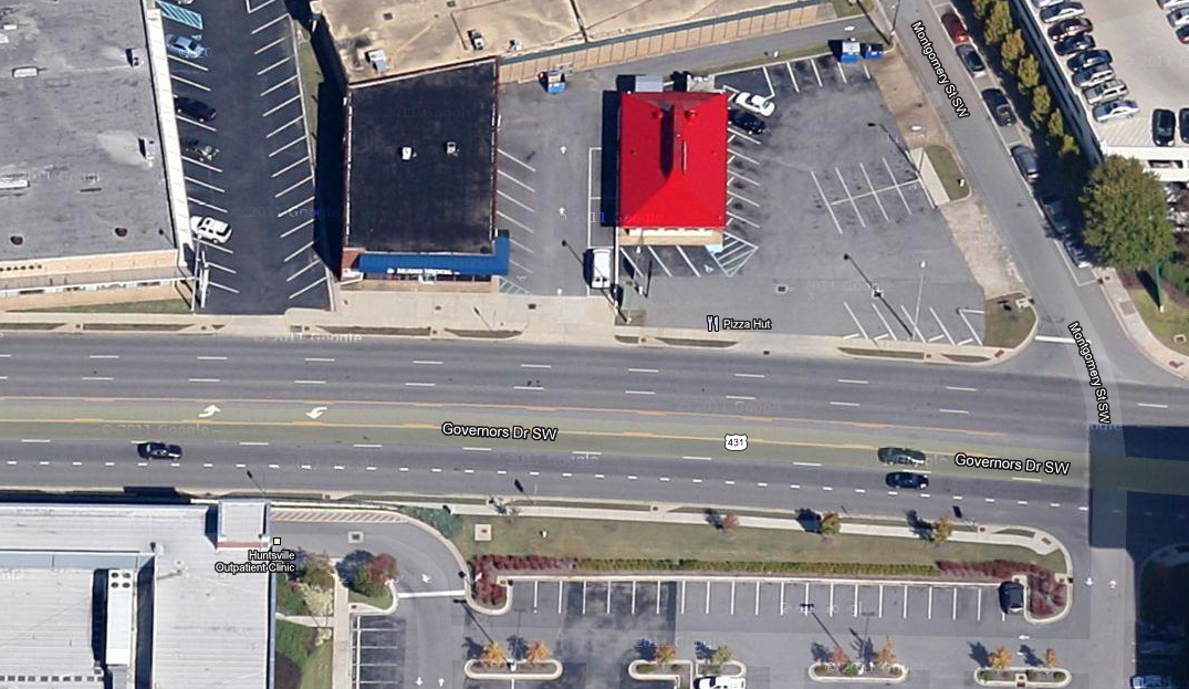
Figure 1: Striping for drop lane on Governors Drive eastbound approaching Gallatin Street. Google Maps Link
I would use this style of striping on the parkway to separate the left two lanes of the parkway from the other lanes that eventually exit off. This reinforces the fact that there are only two lanes that you can get in to stay on the parkway throughout the maze of ramps that you encounter.
The above proposal helps those that stay on the parkway, but many people will either enter or exit the parkway from this interchange complex. The overhead signs do help somewhat in being able to tell which lane you need to be in to get to which road you wish to be on, but additional pavement markings would help even more. My suggestion is to paint a highway shield in every lane to show which lane you need to be in. The closest example of this can be found in Atlanta on I-75/85 in downtown going north before I-75 and I-85 split. This uses text instead of actual highway shields, but the concept is the same:

Highway shields, for those that don’t know what I am talking about, are the signs that you see that have the road numbers in them, such as these:

Figure 3: An example of highway shields
I would paint these on the pavement along with the associated direction (so that you know what lane to be in for I-565 EAST versus I-565 WEST). The state of Texas does this very well.

Figure 4: Highway shields and cardinal directions on pavement along I-610 in Houston, TX. Google maps link
Highway shields can be used instead of road names (US 431 SOUTH instead of Governors Drive, US 72 WEST instead of University Drive, etc.), but this isn’t the case for Clinton Ave or other city streets without highway numbers. For this situation, improved signage could help. Advance signage telling you which lane you need to be in would be helpful, especially as you are exiting off I-565 east to the parkway southbound. Both of those lanes eventually exit off (the right one just ends and the left one exits to Clinton Ave).
These improvements wouldn’t cost a lot of money, and would make sense to do during the repaving projects to occur this summer. I urge ALDOT to consider these improvements for now until the interchange can be rebuilt.